A Laser Pulse Hits the Ground. Your Site Plan Gets Better.
Most developers don’t think about how their survey data gets collected. They just want the map. But the method behind that map affects how fast you get it, how accurate it is and what decisions you can make with it.
LiDAR mapping is one of the fastest ways to collect site data over large or difficult terrain. If you’re planning a development project and haven’t heard of it, here’s what it does and why it matters.
What Is LiDAR Mapping?
LiDAR stands for Light Detection and Ranging. It’s a remote sensing method that uses laser pulses to measure distances between the sensor and the ground below.
The sensor fires thousands of laser pulses per second. Each pulse hits a surface and bounces back. The system records exactly how long that return trip takes. Since light travels at a known speed, the system calculates the precise distance to that surface.
Do that millions of times across a site and you get a dense, three-dimensional picture of the terrain. That picture is called a point cloud.
How Does LiDAR Mapping Work in the Field?
The Equipment
Most LiDAR surveys for land development use a drone-mounted sensor. The drone flies a programmed flight path over the site. As it flies, the sensor fires pulses downward and in multiple directions, collecting return data the entire time.
The system also records GPS coordinates for every pulse. That’s what ties the point cloud to real-world locations on the ground.
The Data Collection Process
The drone completes its flight path. The sensor records millions of data points. Each point has an X coordinate, a Y coordinate and an elevation value.
Back in the office, the surveyor processes that raw data. Software filters out noise, separates ground points from vegetation and structures, and builds a detailed surface model of the site.
That model becomes the basis for contour maps, elevation data, drainage analysis and site planning documents.
What LiDAR Can See That Traditional Methods Miss
LiDAR pulses can pass through gaps in tree canopy. In wooded or overgrown areas, some pulses reach the ground even when the site can’t be easily walked. The system captures ground returns underneath vegetation that would slow a traditional field crew significantly.
That’s a real advantage on sites with heavy tree cover, steep slopes or difficult access.
What LiDAR Mapping Produces
The deliverables from a LiDAR survey depend on the project, but most include:
- A point cloud file showing the full three-dimensional surface
- A Digital Elevation Model (DEM) showing bare ground elevation
- A Digital Surface Model (DSM) showing elevation including structures and vegetation
- Contour lines at specified intervals for site planning
- Drainage and slope analysis maps
Engineers and architects use these outputs to plan grading, drainage, road alignments and building placement. The data integrates directly into CAD and GIS software.
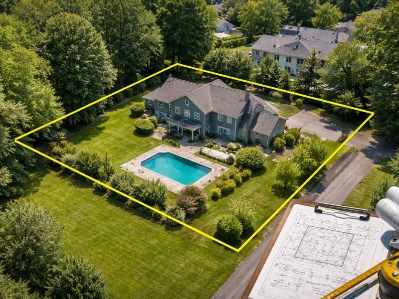
Where LiDAR Mapping Makes the Most Sense
LiDAR isn’t the right tool for every job. For a single residential lot in a flat subdivision, traditional surveying methods work fine and often cost less.
LiDAR earns its place on larger projects. Sites over a few acres, properties with dense vegetation, irregular terrain or projects requiring rapid data collection are where it pulls ahead.
Developers working on subdivision planning, commercial site development, road design or land grading projects on larger tracts get the most value from it. The speed of data collection across a large area is hard to match with ground-based methods alone.
How Accurate Is LiDAR Mapping?
Accuracy depends on flight altitude, sensor quality and ground control points. Ground control points are GPS-surveyed markers placed on the site before the flight. The processing software uses them to calibrate the point cloud to real-world coordinates.
With proper ground control, drone LiDAR surveys typically achieve vertical accuracy within 5 to 10 centimeters. For most site planning and grading work, that’s more than sufficient.
Projects requiring higher legal precision, like boundary establishment, still need a licensed land surveyor’s field work. LiDAR gives you the terrain model. A boundary survey gives you the legal line.
LiDAR Mapping vs. Traditional Topographic Survey
Both methods produce elevation data. The difference is speed and scale.
A traditional topographic survey uses a total station or GPS rover. A crew walks the site and collects individual points by hand. On a one-acre residential lot, that’s efficient. On a 50-acre development tract, it takes significantly longer.
A LiDAR drone flight covers the same 50 acres in a fraction of the time. The point density is also far higher. A traditional crew might collect a few hundred ground points on a site. A LiDAR flight collects millions.
More points means a more detailed surface model, which means better drainage calculations and more accurate grading plans.
5 Frequently Asked Questions
What is LiDAR mapping used for in land development?
LiDAR mapping is used to collect terrain data quickly across large or difficult sites. Developers use it for grading plans, drainage design, road alignment, contour mapping and site feasibility studies. It’s especially useful on wooded or sloped properties where ground access is limited.
Is LiDAR mapping the same as a drone survey?
Not exactly. A drone is the platform that carries the LiDAR sensor. LiDAR is the measurement technology. Some drone surveys use cameras and photogrammetry instead of LiDAR. LiDAR and photogrammetry produce similar outputs but work differently, and LiDAR performs better in areas with heavy vegetation.
How long does a LiDAR mapping survey take?
Flight time depends on site size and complexity.
A 10-acre site might take under an hour to fly. Data processing typically takes one to three days after the flight. Total project turnaround, including processing and deliverable preparation, generally runs three to seven business days.
Can LiDAR replace a boundary survey?
No. LiDAR collects terrain and elevation data. It doesn’t establish legal property boundaries. A licensed land surveyor is required to locate, certify and document boundary lines. Both tools serve different purposes and are often used together on development projects.
How much does a LiDAR mapping survey cost?
Costs vary by site size, terrain and deliverable requirements. Small sites under 10 acres may run $1,500 to $3,500. Larger tracts or projects with complex deliverable requirements cost more. Get a written quote based on your specific site and project scope before committing.