
How to Find Property Lines Before You Build or Dig
What Are Property Lines and Why Do They Matter?
Property lines define exactly where your land starts and ends. If you build on the wrong side of one, you’re in trouble. We’re talking legal disputes, forced demolition, permit rejections and delays that cost real money.
Finding property lines before you break ground isn’t optional. It’s the move that protects your project from the start.
4 Ways to Find Property Lines
1. Check the Recorded Plat at the County Courthouse
Every subdivided property has a recorded plat. That’s a map filed with the county that shows lot dimensions, boundaries and street layouts.
You can usually find it at the county recorder’s office or through the county’s online GIS portal. Search by your parcel number or property address.
What you’ll get is a drawing with measurements. It tells you the shape and size of the lot on paper. What it doesn’t do is show you where those lines fall on the actual ground. For that, you need more.
2. Look for Iron Pins or Survey Markers
Licensed surveyors place iron rods or concrete monuments at property corners when a survey is done. These are physical markers buried at or just below the surface.
Walk the edges of the lot with a metal detector. If markers exist and haven’t been disturbed, you may find them at the corners. Flags or stakes left by a previous surveyor are another sign.
A few things to know:
- Markers disappear. Construction crews knock them out. Landscaping buries them.
- An old marker may no longer be accurate if boundary records changed.
- Finding a marker doesn’t mean you’ve confirmed the line. It’s a clue, not a conclusion.
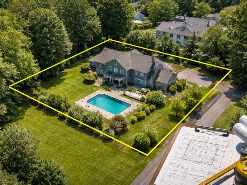
3. Use a County GIS Parcel Viewer
Most counties offer a free online map that shows parcel boundaries layered over satellite imagery. Type in the address and you’ll see the lot outlined on a map.
This is a useful starting point. But parcel viewers are not survey-grade tools. The lines you see on screen can be off by several feet. They’re drawn from deed records and older data, not from GPS field measurements.
Use it to orient yourself. Don’t use it to stake a foundation.
4. Review Your Title Insurance Documents
Your title insurance policy may include a survey or a plat map from when the property last changed hands. Check the closing documents from the purchase. If a survey was done, it lists boundary measurements and sometimes corner locations. It’s not a substitute for a fresh survey, but it tells you what was recorded at the time of sale.
When DIY Methods Aren’t Enough
For most building and excavation projects, you need a licensed land surveyor. Here’s when the DIY options simply don’t cut it:
- You’re pulling a building permit (most jurisdictions require a certified survey)
- The lot corners have no visible markers
- You’re building near a shared boundary with a neighbor
- There’s any history of encroachment or boundary disputes on the property
- The deed description is old, vague or uses references that no longer exist on the ground
A certified boundary survey gives you legally defensible measurements. A surveyor locates the corners, places or confirms markers and provides documentation you can hand to a contractor, a permit office or an attorney.
What Happens If You Skip This Step
Skipping it is a gamble that doesn’t pay off. Here’s what can go wrong:
You build over the line. A neighbor files a complaint. The city or county gets involved. In the worst cases, a structure gets ordered removed. Removal and rebuilding costs far more than a survey ever would.
Your permit gets rejected. Many building departments require a site plan showing the structure’s distance from all property lines. If you can’t prove those measurements, the permit stalls.
You hit an easement. Utility easements, drainage easements and access corridors run through a lot of residential and commercial parcels. Building inside one creates a forced removal situation when the utility company needs access.
5 Frequently Asked Questions
Can I use Google Maps to find my property lines?
Google Maps shows general geography. It doesn’t show legal property boundaries. The lines you see are not accurate enough for construction use and have no legal standing.
How accurate are property line apps?
Most apps pull from county GIS data, which can be off by 5 to 15 feet or more depending on the area. Good enough for a rough look, not good enough for a building decision.
What does a boundary survey cost?
For a standard residential lot, most homeowners pay between $500 and $1,500. Larger tracts, complex terrain or limited historical records push the price up.
Who can legally establish property lines?
Only a licensed professional land surveyor can establish and certify property boundaries. An architect, contractor or GIS technician cannot do this work legally.
How long does a boundary survey take?
Most residential surveys are completed within one to two weeks. Rush timelines are sometimes available depending on the surveyor’s schedule and how quickly county records can be accessed.