
Home Survey Before Adding a Detached Storm Shelter
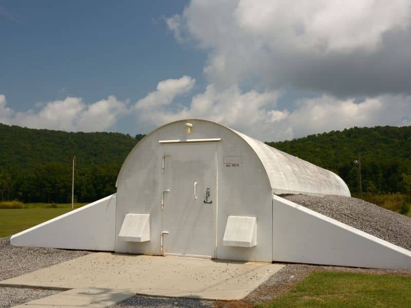
A detached storm shelter can save your family’s life. But put it in the wrong spot, and you could face a legal fight, a costly redo, or a shelter that floods during the very storm it was built to protect you from. Where storms can move in fast, getting the shelter’s location right matters just as much as the shelter itself.
A home survey solves this problem before you dig. It shows your real property lines, setbacks, and buried utilities. This lets you place your shelter in a spot that is safe, legal, and easy to reach.
This article walks through what a home survey should check before you build a detached storm shelter, step by step.
Confirm Property Limits Before Choosing a Shelter Location
The first step is knowing where your property actually ends. Fences, tree lines, and old markers do not always match your real, legal boundary. A home survey finds your true property corners and lines.
Placing a shelter even a few feet over your line can cause a real problem with a neighbor. It could also force you to move or remove the shelter later.
A home survey should confirm:
- Your property corners and boundary lines based on your recorded plat
- Any gap between old fences or markers and your real legal line
- Whether your land has any shared or unclear boundary points
- A clear buildable area once your lines are confirmed
Getting this step right first saves you from picking a shelter spot that turns out to be off-limits.
Check Setbacks and Easements Around the Proposed Site
Once your boundary lines are clear, the next step is checking setbacks and easements. A setback is the required distance a structure must sit from your property line. An easement gives someone else, like a utility company, the legal right to use part of your land.
Building inside a setback or on top of an easement can cause real trouble. You might have to move the shelter, or face a fine from your local building department.
This step should confirm:
- Setback distances that apply to detached structures on your property
- Any recorded easements that cross your yard or the area you want to build in
- Whether utility lines or access rights limit where you can place a shelter
- Whether your shelter plan fits within the buildable area once these limits are applied
Setback and easement rules can vary by county, lot type, and property size, so it is worth confirming exact requirements with local planning staff before you finalize your shelter’s location.
Evaluate Ground Elevations for Shelter Placement
A storm shelter only works well if water stays out of it. This makes ground elevation a key part of the survey. A home survey records the elevation across your yard, so you can see which spots sit higher and drain well, and which ones tend to collect water.
Placing a shelter in a low spot can lead to a shelter that floods, even in a normal rain. That defeats the whole purpose of having one.
Elevation data should show:
- High points and low points across your yard
- Any spots where water already tends to pool
- Slope direction, so you know which way water naturally flows
- A comparison between possible shelter sites, based on drainage
Ringgold’s hilly terrain means elevation can shift quickly across even a small yard. Checking this data helps you pick a spot that stays dry and works the way it should.
Map Nearby Utilities and Existing Residential Improvements
Before you dig for a shelter, you need to know what is already under and around your yard. Buried water lines, sewer lines, gas lines, and electrical conduit can all run through the exact spot you had in mind.
Digging into an unmarked utility line can cause serious damage, and can even be dangerous. A home survey helps map what is nearby so you can avoid it.
This step should identify:
- Buried utility lines running through or near your yard
- Existing structures, like sheds, decks, or fences, near your proposed site
- Septic systems or drain fields, if your property uses one
- Access paths you will need to keep clear for construction equipment
Combining survey data with a utility locate request gives you the most complete picture before digging starts.
Use Survey Data to Support Site and Construction Planning
Once your boundary, setback, elevation, and utility data are all confirmed, that information comes together to support your final shelter plan. This step turns raw survey data into a clear, buildable site plan.
A solid site plan makes permitting faster and gives your contractor exact information to work with, instead of rough guesses.
Survey data supports this step by providing:
- A clear buildable area that meets setback and easement rules
- Confirmed ground elevation to guide shelter placement and drainage
- A record of nearby utilities to share with your contractor
- Documentation you can submit with a building permit application, if required
Requirements can vary by property type, lot size, and county rules, so it is worth confirming your local permitting process early. If your project timeline depends on getting a permit or starting construction by a certain date, order your home survey as soon as possible rather than waiting until your shelter plans are already set.
